
Obrigado por apoiar este site ❤️
Faça uma doação
Faça uma doação
Mapa topográfico Glacier Point
Clique no mapa para exibir a altitude.
Obrigado por apoiar este site ❤️
Faça uma doação
Faça uma doação
Glacier Point
Glacier Point is a viewpoint above Yosemite Valley in the U.S. state of California. It is located on the south wall of Yosemite Valley at an elevation of 7,214 feet (2,199 m), 3,200 feet (980 m) above Curry Village. The point offers a superb view of several of Yosemite National Park's well-known landmarks, including Yosemite Valley, Yosemite Falls, Half Dome, Vernal Fall, Nevada Fall, and Clouds Rest. Between 1872 and 1968, it was the site of the Yosemite Firefall.
Obrigado por apoiar este site ❤️
Faça uma doação
Faça uma doação
Sobre este mapa
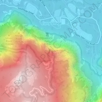
Nome: Mapa topográfico Glacier Point, altitude, relevo.
Altitude média: 1.711 m
Altitude mínima: 1.204 m
Altitude máxima: 2.479 m
Obrigado por apoiar este site ❤️
Faça uma doação
Faça uma doação