
Mapa topográfico Erstfeld
Mapa interativo
Clique no mapa para exibir a altitude.
Sobre este mapa
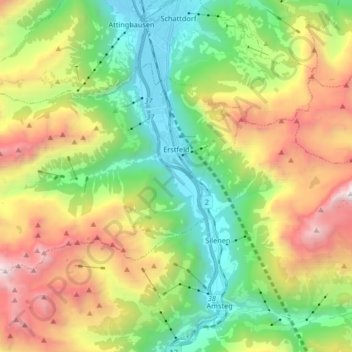
Nome: Mapa topográfico Erstfeld, altitude, relevo.
Local: Erstfeld, Uri, 6472, Schweiz (46.77637 8.51750 46.84932 8.68302)
Altitude média: 1.476 m
Altitude mínima: 444 m
Altitude máxima: 3.173 m
Unter Geologen weltbekannt ist das Scheidnössli am nördlichen Dorfausgang. Hier trifft man vierzehn verschiedene Gesteinsschichten innerhalb von fünf Metern Höhe an.