
Obrigado por apoiar este site ❤️
Faça uma doação
Faça uma doação
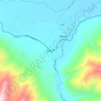
Mapa topográfico Padum
Clique no mapa para exibir a altitude.
Obrigado por apoiar este site ❤️
Faça uma doação
Faça uma doação
Padum
Padum is at the centre of the tri-armed Zanskar valley. It has an average elevation of 3,669 m (12,037 ft). There are several villages to the north-east of Padum leading to Karsha monastery.
Obrigado por apoiar este site ❤️
Faça uma doação
Faça uma doação
Sobre este mapa
Nome: Mapa topográfico Padum, altitude, relevo.
Local: Padum, Zanskar tehsil, Ladakh, 194302, India (33.42914 76.83818 33.50914 76.91818)
Altitude média: 3.847 m
Altitude mínima: 3.491 m
Altitude máxima: 5.332 m
Obrigado por apoiar este site ❤️
Faça uma doação
Faça uma doação