
Obrigado por apoiar este site ❤️
Faça uma doação
Faça uma doação
Mapa topográfico Chillum
Clique no mapa para exibir a altitude.
Obrigado por apoiar este site ❤️
Faça uma doação
Faça uma doação
Chillum
Chilum or Chilam is a village of Astore District in Gilgit-Baltistan, Pakistan. It is located near the junction of the Deosai Road and the Astore–Srinagar road. There is checkpost nearby, referred to as Chilam Chowki, at 35°2'8"N 75°6'10" E and elevation 3869 m (12696 ft).
Obrigado por apoiar este site ❤️
Faça uma doação
Faça uma doação
Sobre este mapa
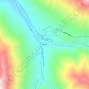
Nome: Mapa topográfico Chillum, altitude, relevo.
Altitude média: 3.700 m
Altitude mínima: 3.280 m
Altitude máxima: 4.547 m
Obrigado por apoiar este site ❤️
Faça uma doação
Faça uma doação
Outros mapas topográficos
Clique em um mapa para visualizar sua topografia, sua altitude e seu relevo.