
Obrigado por apoiar este site ❤️
Faça uma doação
Faça uma doação
Mapa topográfico Clayton
Clique no mapa para exibir a altitude.
Obrigado por apoiar este site ❤️
Faça uma doação
Faça uma doação
Clayton
According to the United States Census Bureau, the city has a total area of 3.1 square miles (8.0 km2), all of it land. The elevation of Clayton's downtown area is 1,925 feet (587 m). A number of hilltops within the city limits exceed 2,200 feet.
Obrigado por apoiar este site ❤️
Faça uma doação
Faça uma doação
Sobre este mapa
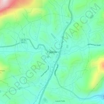
Nome: Mapa topográfico Clayton, altitude, relevo.
Local: Clayton, Rabun County, Georgia, 30525, United States (34.85815 -83.42099 34.89815 -83.38099)
Altitude média: 634 m
Altitude mínima: 509 m
Altitude máxima: 1.014 m
Obrigado por apoiar este site ❤️
Faça uma doação
Faça uma doação