
Mapa topográfico Strohwolln
Mapa interativo
Clique no mapa para exibir a altitude.
Sobre este mapa
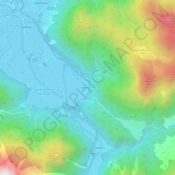
Nome: Mapa topográfico Strohwolln, altitude, relevo.
Altitude média: 958 m
Altitude mínima: 619 m
Altitude máxima: 1.877 m
Outros mapas topográficos
Clique em um mapa para visualizar sua topografia, sua altitude e seu relevo.
Sankt Martin bei Lofer
Österreich > Salzburg > Bezirk Zell am See > Gemeinde Sankt Martin bei Lofer > Sankt Martin bei Lofer
Sankt Martin bei Lofer, Gemeinde Sankt Martin bei Lofer, Bezirk Zell am See, Salzburg, 5092, Österreich
Altitude média: 913 m