
Obrigado por apoiar este site ❤️
Faça uma doação
Faça uma doação
Mapa topográfico Twentynine Palms
Clique no mapa para exibir a altitude.
Obrigado por apoiar este site ❤️
Faça uma doação
Faça uma doação
Twentynine Palms
According to the United States Census Bureau, the city has a total area of 59.1 square miles (153 km2), all land. The city is at an elevation of 1,988 feet (606 m). The Marine Corps Air Ground Combat Center Twentynine Palms is located there.
Obrigado por apoiar este site ❤️
Faça uma doação
Faça uma doação
Sobre este mapa
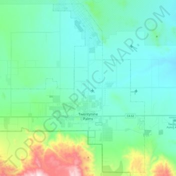
Nome: Mapa topográfico Twentynine Palms, altitude, relevo.
Altitude média: 690 m
Altitude mínima: 489 m
Altitude máxima: 1.546 m
Obrigado por apoiar este site ❤️
Faça uma doação
Faça uma doação