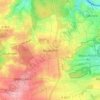
Mapa topográfico Heimsheim
Clique no mapa para exibir a altitude.
Heimsheim
The township (Stadt) Heimsheim covers an area of 14.3 square kilometers (5.5 sq mi) at the very southeastern tip of the Enz district. It is physically located in the foothills of the Black Forest, in the Heckengäu, a region geology is characterized by karstified and wooded muschelkalk hills. Because the Heckengäu is home to a number of protected species of fauna, Heimsheim borders the Feuerbacher Heide-Dickenberg [de], Tiefenbronner Seewiesen [de], Silverberg nature reserve [de], and Betzenbuckel [de] Federal nature reserves. The primary watercourse in Heimsheim is the Kotzenbach (also called the Zieselbach), which drains into the Würm to the southwest. The river flows through a shallow valley carved into the Upper Buntsandstein near Heimsheim's center, and along Enz district's western edge. The Kotzenbach is also the location of Heimsheim's lowest elevation, 392 meters (1,286 ft) NN. The highest elevation, 511 meters (1,677 ft), is the top of a hill on the border with Renningen, in the Böblingen district. The southwest portion of Heimsheim lies in the Upper Gäu [de] while the northern and eastern portion is made up by Upper Muschelkalk [de] and the west of Middle [de] and Lower Muschelkalk [de].
Sobre este mapa
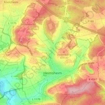
Nome: Mapa topográfico Heimsheim, altitude, relevo.
Altitude média: 450 m
Altitude mínima: 366 m
Altitude máxima: 517 m
Outros mapas topográficos
Clique em um mapa para visualizar sua topografia, sua altitude e seu relevo.