
Mapa topográfico Halle
Mapa interativo
Clique no mapa para exibir a altitude.
Sobre este mapa
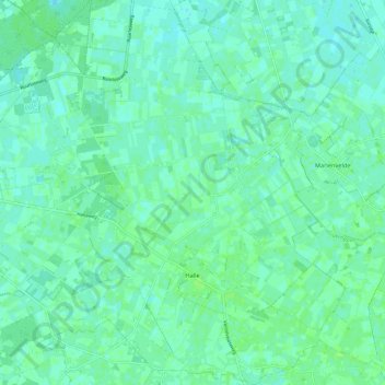
Nome: Mapa topográfico Halle, altitude, relevo.
Local: Halle, Bronckhorst, Gelderland, Nederland (51.96970 6.37248 52.04283 6.47577)
Altitude média: 19 m
Altitude mínima: 15 m
Altitude máxima: 22 m
Outros mapas topográficos
Clique em um mapa para visualizar sua topografia, sua altitude e seu relevo.
Bronkhorst
Nederland > Gelderland > Bronckhorst
Bronkhorst, Bronckhorst, Gelderland, Nederland
Altitude média: 8 m
Oude IJssel
Nederland > Gelderland > Bronckhorst
Oude IJssel, Rijksweg, Laag-Keppel, Bronckhorst, Gelderland, Nederland, 6998AJ, Nederland
Altitude média: 12 m
Kasteel Vorden
Nederland > Gelderland > Bronckhorst
Kasteel Vorden, 8, De Horsterkamp, Vorden, Bronckhorst, Gelderland, Nederland, 7251AZ, Nederland
Altitude média: 14 m