
Mapa topográfico Perez
Clique no mapa para exibir a altitude.
Sobre este mapa
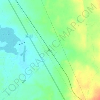
Nome: Mapa topográfico Perez, altitude, relevo.
Local: Perez, Modoc County, California, United States (41.65627 -121.27415 41.69627 -121.23415)
Altitude média: 1.277 m
Altitude mínima: 1.260 m
Altitude máxima: 1.307 m
Outros mapas topográficos
Clique em um mapa para visualizar sua topografia, sua altitude e seu relevo.
Alturas
United States > California > Modoc County
Alturas (Spanish for "Heights"; Achumawi: Kasalektawi) is a city and the county seat of Modoc County, California. Located in the Shasta Cascade region of Northern California, the city had a population of 2,715 at the 2020 census. Alturas is located at the confluence of the south and north forks of the Pit…
Altitude média: 1.336 m
Lake City
United States > California > Modoc County
Lake City (formerly, Tri-Lake City) is a census-designated place in Modoc County, California, United States. It is located 8.5 miles (14 km) north-northwest of Cedarville, at an elevation of 4,626 feet (1,410 m). Its population is 71 as of the 2020 census, up from 61 from the 2010 census.
Altitude média: 1.583 m
Adin
United States > California > Modoc County > Adin
Adin (formerly, Adinville and Aidenville) is a census-designated place in Modoc County, California, United States. It is located 29 miles (47 km) southwest of Alturas, at an elevation of 4,203 feet (1,281 m). Its population is 205 as of the 2020 census, down from 272 from the 2010 census.
Altitude média: 1.305 m
Likely
United States > California > Modoc County
Likely (formerly, South Fork) is a census-designated place in Modoc County, California, United States. It is located near the South Fork of the Pit River, 18 miles (29 km) south of the county seat of Alturas, at an elevation of 4,449 feet (1,356 m). Its population is 53 as of the 2020 census, down from 63 at…
Altitude média: 1.364 m
Alturas
United States > California > Modoc County
Alturas (Spanish for "Heights"; Achumawi: Kasalektawi) is a city and the county seat of Modoc County, California. Located in the Shasta Cascade region of Northern California, the city had a population of 2,715 at the 2020 census. Alturas is located at the confluence of the south and north forks of the Pit…
Altitude média: 1.337 m
Alturas
United States > California > Modoc County
Alturas (Spanish for "Heights"; Achumawi: Kasalektawi) is the only incorporated city in Modoc County, California of which it is also the county seat. Located in the Shasta Cascade region of Northern California, the city had a population of 2,715 at the 2020 census. Alturas is located at the confluence of the…
Altitude média: 1.337 m