
Mapa topográfico New Chapel
Clique no mapa para exibir a altitude.
Sobre este mapa
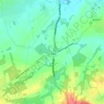
Nome: Mapa topográfico New Chapel, altitude, relevo.
Altitude média: 64 m
Altitude mínima: 46 m
Altitude máxima: 105 m
Outros mapas topográficos
Clique em um mapa para visualizar sua topografia, sua altitude e seu relevo.
Warlingham
United Kingdom > England > Surrey > Tandridge
Elevations vary from 110m AOD at Woldingham Road, at the southernmost point of the parish, with a gentle increase in height through the village along the main road heading to the southeast, to the highest elevation (199.6m) at Limpsfield Road.
Altitude média: 163 m