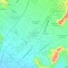
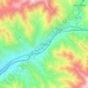
Mapa topográfico Carabayllo
Clique no mapa para exibir a altitude.
Carabayllo
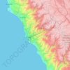
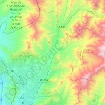
Carabayllo was the first district to be created by decree in the Lima Province by General José de San Martín in the independence era on August 4, 1821. At that time the district occupied the whole Chillón valley north of the Rímac River up to the Canta province. In principle, the district was the only one in the north, and included the districts of: Ancón, Santa Rosa, Puente Piedra, Ventanilla, Comas, San Martín de Porres, Independencia, Los Olivos, Santa Rosa de Quives and part of Rímac District. Through the years the district lost most of its territory to newly created districts following the growth of economic activity and the growth of the population in the area. This process started as early as 1874 when the Ancón District was created and continued to as recent as 1961 when the Comas District was created and as recent as 1969 when the Ventanilla District was founded in neighboring Callao Province. Carabayllo still remains the largest district in Lima with an area of 346 km2 and a population of about 200,000 (2005). Carabayllo is a zone of recent expansion to the city. The principal road connecting the district to the rest of the metropolis is the Tupac Amaru Avenue. It is at an altitude of 238 meters above sea level. Its social economic level is principally made up of middle and lower middle classes.
Sobre este mapa
Nome: Mapa topográfico Carabayllo, altitude, relevo.
Altitude média: 800 m
Altitude mínima: 4 m
Altitude máxima: 2.434 m
Outros mapas topográficos
Clique em um mapa para visualizar sua topografia, sua altitude e seu relevo.
Lima
The suburban district of Cieneguilla, the district of Pachacámac and the district of Chosica provide important tourist attractions among locals. Due to its elevation (over 500 masl), the sun shines in Chosica during the winter, being very visited by the residents of Lima to escape the urban fog.
Altitude média: 236 m


Lima
The suburban district of Cieneguilla, the district of Pachacámac and the district of Chosica provide important tourist attractions among locals. Due to its elevation (over 500 masl), the sun shines in Chosica during the winter, being very visited by the residents of Lima to escape the urban fog.
Altitude média: 236 m



Morro Solar
Peru > Lima > Chorrillos
Morro Solar, a cluster of hills, is roughly 251 metres (823 ft) in elevation. It lies near Chorrillos, a southern suburb of Lima, occupying an area of 7.48 square kilometres (2.89 sq mi). Alexander George Findlay described it as "a remarkable cluster of hills, standing on a sandy plain; when seen from the…
Altitude média: 38 m
Lima
The suburban district of Cieneguilla, the district of Pachacámac and the district of Chosica provide important tourist attractions among locals. Due to its elevation (over 500 masl), the sun shines in Chosica during the winter, being very visited by the residents of Lima to escape the urban fog.
Altitude média: 202 m



Lima
The suburban district of Cieneguilla, the district of Pachacámac and the district of Chosica provide important tourist attractions among locals. Due to its elevation (over 500 masl), the sun shines in Chosica during the winter, being very visited by the residents of Lima to escape the urban fog.
Altitude média: 236 m




Lima
The suburban district of Cieneguilla, the district of Pachacámac and the district of Chosica provide important tourist attractions among locals. Due to its elevation (over 500 masl), the sun shines in Chosica during the winter, being very visited by the residents of Lima to escape the urban fog.
Altitude média: 236 m

Lima
The suburban district of Cieneguilla, the district of Pachacámac and the district of Chosica provide important tourist attractions among locals. Due to its elevation (over 500 masl), the sun shines in Chosica during the winter, being very visited by the residents of Lima to escape the urban fog.
Altitude média: 202 m






Lima
The suburban district of Cieneguilla, the district of Pachacámac and the district of Chosica provide important tourist attractions among locals. Due to its elevation (over 500 masl), the sun shines in Chosica during the winter, being very visited by the residents of Lima to escape the urban fog.
Altitude média: 236 m
Lima
The suburban district of Cieneguilla, the district of Pachacámac and the district of Chosica provide important tourist attractions among locals. Due to its elevation (over 500 masl), the sun shines in Chosica during the winter, being very visited by the residents of Lima to escape the urban fog.
Altitude média: 236 m