
Mapa topográfico Moers
Clique no mapa para exibir a altitude.
Sobre este mapa
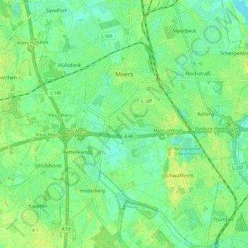
Nome: Mapa topográfico Moers, altitude, relevo.
Local: Moers, Kreis Wesel, Nordrhein-Westfalen, Deutschland (51.40816 6.57932 51.46951 6.67874)
Altitude média: 29 m
Altitude mínima: 21 m
Altitude máxima: 37 m
Outros mapas topográficos
Clique em um mapa para visualizar sua topografia, sua altitude e seu relevo.
Halde Rheinpreußen
Deutschland > Nordrhein-Westfalen > Kreis Wesel > Moers
Die Halde Rheinpreußen ist eine 74 m über Umgebungsniveau aufgeschüttete Bergehalde in Moers-Meerbeck. Sie hat eine Gesamthöhe von 103 m ü. NN. Eigentümer ist seit dem Jahr 2001 der Regionalverband Ruhr.
Altitude média: 30 m