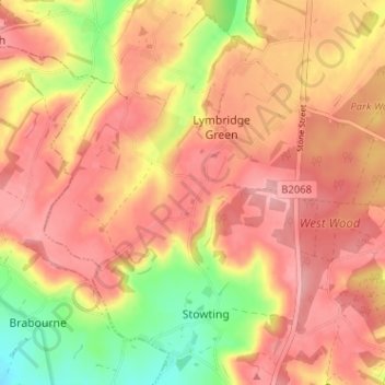
Mapa topográfico Stowting Common
Clique no mapa para exibir a altitude.
Sobre este mapa
Nome: Mapa topográfico Stowting Common, altitude, relevo.
Altitude média: 148 m
Altitude mínima: 75 m
Altitude máxima: 188 m

Clique no mapa para exibir a altitude.
Nome: Mapa topográfico Stowting Common, altitude, relevo.
Altitude média: 148 m
Altitude mínima: 75 m
Altitude máxima: 188 m