
Mapa topográfico Phu Ruea
Mapa interativo
Clique no mapa para exibir a altitude.
Sobre este mapa
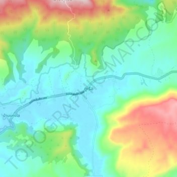
Nome: Mapa topográfico Phu Ruea, altitude, relevo.
Local: Phu Ruea, Loei Province, 42160, Thailand (17.41170 101.32196 17.49170 101.40196)
Altitude média: 752 m
Altitude mínima: 600 m
Altitude máxima: 1.130 m
The Phu Ruea High Altitude Agricultural Research Station is on the mountain and Phu Ruea National Park encompasses the peak. The park borders Sainyabuli province in Laos at its northern end. Most of the mountain is covered in mixed evergreen forest. The area around the mountain is part of the Luang Prabang montane rain forests ecoregion.
Outros mapas topográficos
Clique em um mapa para visualizar sua topografia, sua altitude e seu relevo.
Phu Kradueng
Thailand > Loei Province > Phu Kradueng
Phu Kradueng, Loei Province, 42180, Thailand
Altitude média: 264 m