
Faça uma doação
Mapa topográfico Plainfield
Clique no mapa para exibir a altitude.
Faça uma doação
Plainfield
Like its namesake, Plainfield's topography is generally flat. Thousands of years ago, land in greater Plainfield used to be part of the bed of proglacial Lake Wauponsee. However, the lake did not hold up long, and eventually drained into the Illinois River valley. The lake left behind a very flat landscape. Much of downtown Plainfield has an elevation of around 600–625 feet (183–191 m) above sea level, with some areas in the western and northwestern portions of the village's outskirts exceeding 700 feet (210 m). This rise in elevation was created by terminal moraines that were formed during the Wisconsin Episode of the last ice age's last glacial period that has been recorded.
Faça uma doação
Sobre este mapa
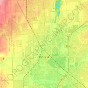
Nome: Mapa topográfico Plainfield, altitude, relevo.
Altitude média: 194 m
Altitude mínima: 148 m
Altitude máxima: 236 m
Faça uma doação
Outros mapas topográficos
Clique em um mapa para visualizar sua topografia, sua altitude e seu relevo.