
Faça uma doação
Mapa topográfico Cashel
Clique no mapa para exibir a altitude.
Faça uma doação
Cashel
The Rock of Cashel, to which the town below owes its origin, is an isolated elevation of stratified limestone, rising abruptly from a broad and fertile plain called the Golden Vale. The top of this eminence is crowned by a group of remarkable ruins. Originally known as Fairy Hill, or Sid-Druim, the Rock was, in pagan times, the dun, or castle, of the ancient Eoghnacht Chiefs of Munster. In Gaelic, Caiseal denotes a circular stone fort and is the name of several places in Ireland. The "Book of Rights" suggests the name is derived from Cais-il, i.e. "tribute stone", because the Munster tribes paid tribute on the Rock. Here Corc, grandfather of Aengus Mac Natfraich, erected a fort. Cashel subsequently became the capital of Munster and, like Tara and Armagh, it was a celebrated court. At the time of St. Patrick, when Aengus ruled as king, Cashel claimed supremacy over all the royal duns of the province.
Faça uma doação
Sobre este mapa
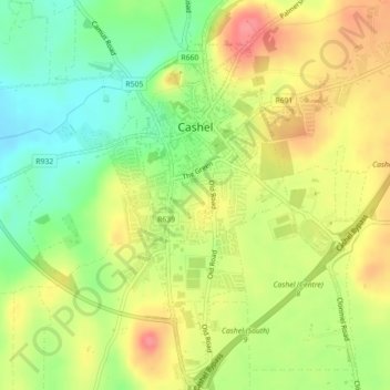
Nome: Mapa topográfico Cashel, altitude, relevo.
Altitude média: 115 m
Altitude mínima: 77 m
Altitude máxima: 154 m
Faça uma doação
Outros mapas topográficos
Clique em um mapa para visualizar sua topografia, sua altitude e seu relevo.
Faça uma doação
Faça uma doação
Faça uma doação
Faça uma doação
Faça uma doação
Faça uma doação