
Mapa topográfico Cripple Creek
Mapa interativo
Clique no mapa para exibir a altitude.
Sobre este mapa
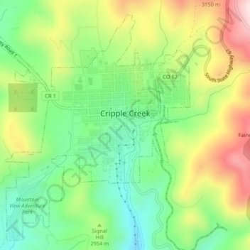
Nome: Mapa topográfico Cripple Creek, altitude, relevo.
Altitude média: 2.946 m
Altitude mínima: 2.796 m
Altitude máxima: 3.165 m
For many years, Cripple Creek's high valley, at an elevation of 9,494 feet (2,894 m), was considered no more important than a cattle pasture. Many prospectors avoided the area after the Mount Pisgah hoax, a mini gold rush caused by salting (adding gold to worthless rock).