
Mapa topográfico Rotbühl
Mapa interativo
Clique no mapa para exibir a altitude.
Sobre este mapa
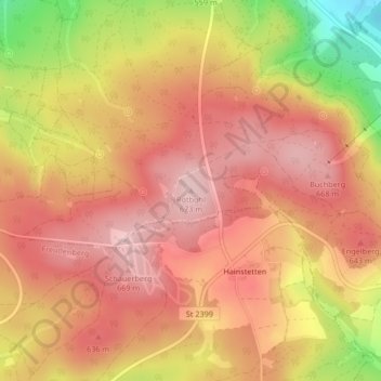
Nome: Mapa topográfico Rotbühl, altitude, relevo.
Altitude média: 601 m
Altitude mínima: 452 m
Altitude máxima: 676 m
Outros mapas topográficos
Clique em um mapa para visualizar sua topografia, sua altitude e seu relevo.
Mertenberg
Deutschland > Bayern > Landkreis Amberg-Sulzbach > Schnaittenbach
Mertenberg, Schnaittenbach, Landkreis Amberg-Sulzbach, Bayern, 92253, Deutschland
Altitude média: 540 m
Neuersdorf
Deutschland > Bayern > Landkreis Amberg-Sulzbach > Schnaittenbach > Neuersdorf
Neuersdorf, Schnaittenbach, Landkreis Amberg-Sulzbach, Bayern, Deutschland
Altitude média: 445 m