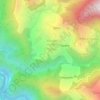
Mapa topográfico Pindar
Clique no mapa para exibir a altitude.
Pindar
The Pindar River is a river located in Uttarakhand, India. The Pindar originates from Pindari Glacier which is located in Bageshwar district of Kumaon region in Uttarakhand. The source of this river, the Pindar glacier is located at an altitude of 3,820 m (12,530 ft). Pindar glacier has relatively easier access and has been documented well for its retreat over 100 years. Pindar river mouth is located at Karnaprayag where it flows into Alaknanda River.
Sobre este mapa

Nome: Mapa topográfico Pindar, altitude, relevo.
Local: Pindar, Tharali, Chamoli District, Uttarakhand, India (30.01888 79.21598 30.27469 80.00852)
Altitude média: 2.533 m
Altitude mínima: 802 m
Altitude máxima: 7.782 m
Outros mapas topográficos
Clique em um mapa para visualizar sua topografia, sua altitude e seu relevo.