
Mapa topográfico Nicksville
Mapa interativo
Clique no mapa para exibir a altitude.
Sobre este mapa
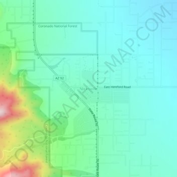
Nome: Mapa topográfico Nicksville, altitude, relevo.
Altitude média: 1.483 m
Altitude mínima: 1.387 m
Altitude máxima: 1.824 m
Nicksville is a populated place in Cochise County, Arizona, just north of the international border between the United States and Mexico. It has an estimated elevation of 4,816 feet (1,468 m) above sea level.