
Faça uma doação
Mapa topográfico Dayton
Clique no mapa para exibir a altitude.
Faça uma doação
Dayton
Dayton's climate features warm, muggy summers and cold, dry winters, and is classified as a humid continental climate (Köppen Dfa). Unless otherwise noted, all normal figures quoted within the text below are from the official climatology station, Dayton International Airport, at an elevation of 1,000 ft (304.8 m) about 10 mi (16 km) to the north of downtown Dayton, which lies within the valley of the Miami River; thus temperatures there are typically cooler than in downtown.
Faça uma doação
Sobre este mapa
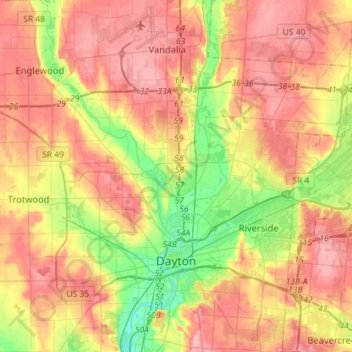
Nome: Mapa topográfico Dayton, altitude, relevo.
Local: Dayton, Montgomery County, Ohio, United States (39.70185 -84.31138 39.92082 -84.09294)
Altitude média: 270 m
Altitude mínima: 212 m
Altitude máxima: 317 m
Faça uma doação
Outros mapas topográficos
Clique em um mapa para visualizar sua topografia, sua altitude e seu relevo.
Faça uma doação
Faça uma doação
Faça uma doação