
Mapa topográfico St. Joseph Island
Mapa interativo
Clique no mapa para exibir a altitude.
St. Joseph Island
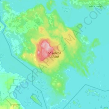
Its highest point, known colloquially and by surveyors as "the Mountain," is near the centre of the island near Carterton with an elevation of 345.6 m, which is about 169 m above Lake Huron.
Sobre este mapa
Nome: Mapa topográfico St. Joseph Island, altitude, relevo.
Altitude média: 196 m
Altitude mínima: 171 m
Altitude máxima: 348 m