
Mapa topográfico Bharuch
Mapa interativo
Clique no mapa para exibir a altitude.
Bharuch
Bharuch is located at 21°42′N 72°58′E / 21.7°N 72.97°E / 21.7; 72.97. It has an average elevation of 15 metres (49 feet). Bharuch is a port city situated on the banks of the Narmada river. The damming of the Narmada caused the original port facilities to close, the nearest port is now in Dahej. The Bharuch district is surrounded by Vadodara (North), Narmada (East) and Surat (South) districts. To the west is the Gulf of Khambhat.
Sobre este mapa
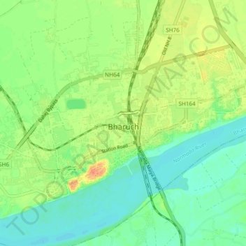
Nome: Mapa topográfico Bharuch, altitude, relevo.
Local: Bharuch, Bharuch Taluka, Bharuch District, Gujarat, India (21.68519 72.96262 21.73299 73.03773)
Altitude média: 15 m
Altitude mínima: 0 m
Altitude máxima: 38 m