
Obrigado por apoiar este site ❤️
Faça uma doação
Faça uma doação
Mapa topográfico Inks Lake State Park
Clique no mapa para exibir a altitude.
Obrigado por apoiar este site ❤️
Faça uma doação
Faça uma doação
Inks Lake State Park
Conservation Pool Elevation usually stays around 888.22 ft. msl; however, this lake does fluctuate about 1 foot annually. Inks lake water clarity can be seen as clear to slightly stained mostly throughout the year. It tends to have higher turbidity during the rainy season due to excessive amounts of runoff.
Obrigado por apoiar este site ❤️
Faça uma doação
Faça uma doação
Sobre este mapa
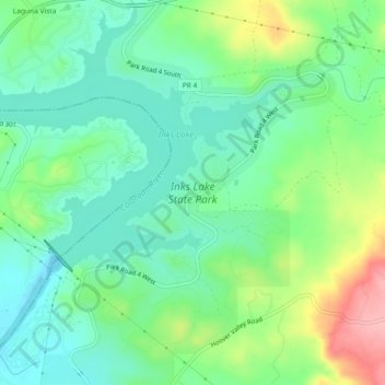
Nome: Mapa topográfico Inks Lake State Park, altitude, relevo.
Altitude média: 294 m
Altitude mínima: 253 m
Altitude máxima: 383 m
Obrigado por apoiar este site ❤️
Faça uma doação
Faça uma doação