
Mapa topográfico Underwood
Clique no mapa para exibir a altitude.
Sobre este mapa
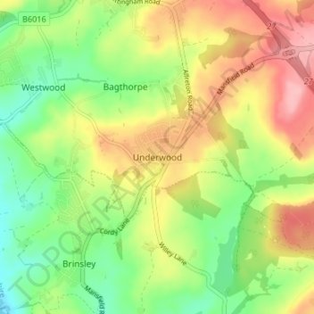
Nome: Mapa topográfico Underwood, altitude, relevo.
Altitude média: 116 m
Altitude mínima: 60 m
Altitude máxima: 181 m
Outros mapas topográficos
Clique em um mapa para visualizar sua topografia, sua altitude e seu relevo.
Sutton Lawn
United Kingdom > England > Nottinghamshire > Ashfield > Sutton-in-Ashfield
Altitude média: 155 m
Sutton in Ashfield
United Kingdom > England > Nottinghamshire > Ashfield > Stanton Hill
Altitude média: 154 m