
Mapa topográfico Boring
Mapa interativo
Clique no mapa para exibir a altitude.
Boring
Boring's landscape is hilly, with its elevation ranging between 548 feet (167 m) and 755 feet (230 m). Several creeks run west through the community limits into the Clackamas River, including Doane Creek, North Fork Deep Creek, and Tickle Creek.
Sobre este mapa
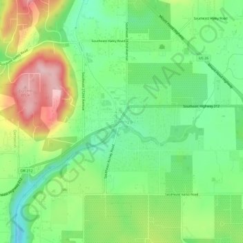
Nome: Mapa topográfico Boring, altitude, relevo.
Altitude média: 183 m
Altitude mínima: 104 m
Altitude máxima: 308 m