
Mapa topográfico Bartlesville
Mapa interativo
Clique no mapa para exibir a altitude.
Sobre este mapa
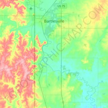
Nome: Mapa topográfico Bartlesville, altitude, relevo.
Local: Bartlesville, Washington County, Oklahoma, United States (36.57206 -96.01276 36.78339 -95.88979)
Altitude média: 231 m
Altitude mínima: 189 m
Altitude máxima: 317 m
Outros mapas topográficos
Clique em um mapa para visualizar sua topografia, sua altitude e seu relevo.
Dewey
United States > Oklahoma > Washington County
Dewey, Washington County, Oklahoma, 74029, United States
Altitude média: 211 m
Bartlesville
United States > Oklahoma > Washington County > Bartlesville
Bartlesville, Washington County, Oklahoma, 74003-4330, United States
Altitude média: 241 m