
Mapa topográfico Helvellyn
Clique no mapa para exibir a altitude.
Helvellyn
Red Tarn, a classic corrie tarn, is a high-elevation tarn with low nutrient levels and poor in the number of species it supports. Characteristic vegetation zones include a water-starwort (Callitriche) in shallower areas and the alga Nitella flexilis in deeper water and around the inlet. Other species include a pondweed (Potamogeton) which grows in 2–3 m (7–10 ft) of water and the rush Juncus bulbosus. Brown trout and schelly, a species of whitefish, are found in the tarn.
Sobre este mapa
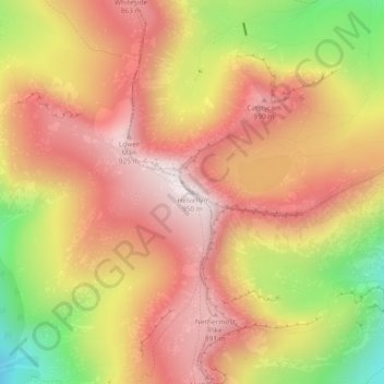
Nome: Mapa topográfico Helvellyn, altitude, relevo.
Altitude média: 680 m
Altitude mínima: 277 m
Altitude máxima: 943 m
Outros mapas topográficos
Clique em um mapa para visualizar sua topografia, sua altitude e seu relevo.
Brothers Water
United Kingdom > England > Westmorland and Furness > Patterdale > Hartsop
Altitude média: 298 m