

Mapa topográfico Odisha
Clique no mapa para exibir a altitude.
Odisha
Three-quarters of the state is covered in mountain ranges. Deep and broad valleys have been made in them by rivers. These valleys have fertile soil and are densely populated. Odisha also has plateaus and rolling uplands, which have lower elevation than the plateaus. The highest point in the state is Deomali at 1,672 metres in Koraput district. Some other high peaks are: Sinkaram (1,620 m), Golikoda (1,617 m), and Yendrika (1,582 metres).
Sobre este mapa
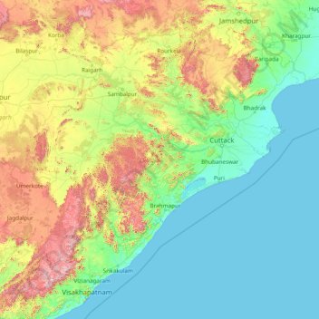
Nome: Mapa topográfico Odisha, altitude, relevo.
Local: Odisha, India (17.81227 81.38859 22.56759 87.48614)
Altitude média: 228 m
Altitude mínima: -1 m
Altitude máxima: 1.585 m
Outros mapas topográficos
Clique em um mapa para visualizar sua topografia, sua altitude e seu relevo.

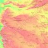
Maharashtra
Maharashtra is the third largest state by area in India. The Western Ghats better known as Sahyadri, are a hilly range running parallel to the coast, at an average elevation of 1,200 metres (4,000 ft). Kalsubai, a peak in the Sahyadris, near Nashik city is the highest elevated point in Maharashtra. To the west…
Altitude média: 478 m


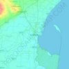
Kakinada
India > Andhra Pradesh > Kakinada (Urban)
Kakinada is located at 16°56′N 82°13′E / 16.93°N 82.22°E / 16.93; 82.22. The 82-degrees east longitude passes through the city. It has an average elevation of 2 metres (6 ft), and many areas of the city are below sea level.
Altitude média: 7 m
Jammu
India > Jammu and Kashmir > Jammu
Jammu is located at 32°44′N 74°52′E / 32.73°N 74.87°E / 32.73; 74.87. It has an average elevation of 300 m (980 ft). Jammu city lies at uneven ridges of low heights at the Shivalik hills. It is surrounded by the Shivalik range to the north, east, and southeast while the Trikuta Range surrounds…
Altitude média: 367 m


Darbhanga
Darbhanga is located in the northern part of Bihar. It lies between 25.53 degrees - 26.27 degrees N and 85.45 degrees - 86.25 degrees E at an average elevation of 171 feet (52 m). Darbhanga district covers an area of 2,279 sq km. Darbhanga is bounded by Madhubani district in the north, Samastipur district in…
Altitude média: 50 m
Kalaburagi
India > Karnataka > Kalaburagi taluku
The entire district is on the Deccan Plateau, and the elevation ranges from 300 to 750 m above MSL. Two main rivers, the Krishna and Bhima, flow through the district. The predominant soil type is black soil. The district has many tanks, which irrigate the land along with the river. The Upper Krishna Project is…
Altitude média: 465 m
Thiruvananthapuram
India > Kerala > Thiruvananthapuram
Thiruvananthapuram is built on seven hills by the seashore and is at 8°30′N 76°54′E / 8.5°N 76.9°E / 8.5; 76.9 on the west coast, near the southern tip of mainland India. The city is on the west coast of India and is bounded by the Laccadive Sea to its west and the Western Ghats to its east.…
Altitude média: 33 m
Surat
India > Gujarat > Katargam Taluka > Surat
Surat is a port city situated on the banks of the Tapi river. Damming of the Tapi caused the original port facilities to close; the nearest port is now in the Magadalla and Hazira area of Surat Metropolitan Region.It has famous beach called 'Dumas Beach' located in Hazira. The city is located at 21°10′N…
Altitude média: 11 m


Bengaluru
India > Karnataka > Bangalore North
Bengaluru lies in the southeast of the South Indian state of Karnataka in the heart of the Mysore Plateau (a region of the larger Deccan Plateau) at an average elevation of 900 m (2,953 ft). The city covers an area of 741 km2 (286 sq mi). The Bengaluru metropolitan region covers an area of 7,005 km2 (2,705 sq…
Altitude média: 879 m

Kodaikanal
India > Tamil Nadu > Kodaikanal
Kodaikanal has a monsoon-influenced subtropical highland climate (Cfb, according to the Köppen climate classification, with a Cwb tendency). The temperatures are cool throughout the year due to the high elevation of the city.
Altitude média: 1.958 m
Western Ghats
The range starts near south of the Tapti river and runs approximately 1,600 km (990 mi) through the states of Gujarat, Maharashtra, Karnataka, Goa, Kerala and Tamil Nadu ending at Marunthuvazh Malai, Swamithope near the southern tip of India. These hills cover 160,000 km2 (62,000 sq mi) and form the catchment…
Altitude média: 2.225 m
Lucknow
India > Uttar Pradesh > Lucknow
Lucknow stands at an elevation of approximately 123 metres (404 ft) above sea level. The city had an area of 402 km2 (155 square miles) until December 2019, when 88 villages were added to the municipal limits and the area increased to 631 km2 (244 square miles). Bounded on the east by Barabanki, on the west by…
Altitude média: 120 m







Bengaluru
India > Karnataka > Bangalore North
Bengaluru lies in the southeast of the South Indian state of Karnataka in the heart of the Mysore Plateau (a region of the larger Deccan Plateau) at an average elevation of 900 m (2,953 ft). The city covers an area of 741 km2 (286 sq mi). The Bengaluru metropolitan region covers an area of 7,005 km2 (2,705 sq…
Altitude média: 879 m




Panaji
Panaji was annexed by India with the rest of Goa and the former Portuguese territories after the Indian annexation of Portuguese India in 1961. It became a state-capital on Goa's elevation to statehood in 1987. Between 1961 and 1987, it was the capital of the Union Territory of Goa, Daman and Diu. A new…
Altitude média: 19 m
Leh
Leh (/ˈlɛ/) (Ladakhi: གླེ) is the joint capital and largest city of Ladakh, a union territory of India. Leh, located in the Leh district, was also the historical capital of the Kingdom of Ladakh, the seat of which was in the Leh Palace, the former residence of the royal family of Ladakh, built in the…
Altitude média: 4.294 m


Udaipur
India > Rajasthan > Girwa Tehsil
Udaipur is located at 24°31′30″N 73°40′38″E / 24.525049°N 73.677116°E / 24.525049; 73.677116. The city covers an area of 64 km2 (25 sq mi) and lies at an altitude of 598.00 m (1,962 ft) above sea level. It is located in the southern region of Rajasthan, near the Gujarat border. The city…
Altitude média: 656 m

Dehradun
India > Uttarakhand > Dehradun
The city of Dehradun mainly lies in Doon Valley and is at a varying height from 410 m (1,350 ft) in Clement Town to above 700 m (2,300 ft) at Malsi which is 15 km (9.3 mi) from the city. However, the average elevation is 450 m (1,480 ft) above sea level. Malsi is the starting point of Lesser Himalayan Range…
Altitude média: 904 m


Kullu
India > Himachal Pradesh > Kullu
Kullu town has an average elevation of 1,278 m (4,193 ft). It lies on the bank of Beas River. A major tributary, Sarvari, (derived from "Shiv-Baardi") leads to the less explored and steeper Lug-valley on the west. On the east of Kullu lies a broad mountainous ridge having the village-temples of Bijli Mahadev,…
Altitude média: 1.808 m





Chennai
Chennai is located on the south–eastern coast of India in the north–eastern part of Tamil Nadu on a flat coastal plain known as the Eastern Coastal Plains. Its average elevation is around 6.7 metres (22 ft), and its highest point is 60 m (200 ft). Chennai is 2,184 kilometres (1,357 mi) south of Delhi,…
Altitude média: 7 m


Tarkeshwar
India > West Bengal > Tarakeswar
Tarakeswar is located at 22°53′N 88°01′E / 22.89°N 88.02°E / 22.89; 88.02. It has an average elevation of 18 metres (59 feet). It is in the Chandannagore sub-division, in the middle of the district, in Hooghly District of Burdwan Division in the state of West Bengal. The town is connected both…
Altitude média: 13 m
Bir
India > Himachal Pradesh > Baijnath
The paragliding launch site is in the meadow at Billing (14 km north of Bir), at an elevation of 2400 meters, while the landing site and most tourist accommodations are in the village of Chowgan (also spelled Chaugan), on the southern edge of Bir.
Altitude média: 1.628 m



Nurpur
India > Himachal Pradesh > Nurpur
Nurpur is located at 32°18′N 75°54′E / 32.3°N 75.9°E / 32.3; 75.9. It has an average elevation of 643 metres (2109 feet).
Altitude média: 536 m



Kargil
India > Ladakh > Kargil tehsil
Kargil has an average elevation of 2,676 metres (8,780 feet), and is situated along the banks of the Suru River (Indus). The town of Kargil is located 205 km (127 mi) from Srinagar, facing the Northern Areas across the LOC. Like other areas in the Himalayas, Kargil has a temperate climate. Summers are hot with…
Altitude média: 3.262 m
Dharamshala
India > Himachal Pradesh > Dharamshala
Dharamshala has an average elevation of 1,457 m (4,780 ft), covering an area of almost 8.51 km2 (3.29 sq mi). Dharamsala is located in the Kangra Valley, in the shadow of the Dhauladhar mountains.
Altitude média: 1.781 m


Sagar
India > Madhya Pradesh > Sagar Nagar Tahsil
Sagar has an average elevation of 427 metres (1401 ft) and is located in the central part of India, just north of the upper limit of the Vindhya mountain ranges.here is a lake in middle of the city.
Altitude média: 515 m


Pathanamthitta
Pathanamthitta has an average elevation of 18 metres (62 ft) above sea level.
Altitude média: 63 m
Guwahati
Professor Abani Kumar Bhagawati of Gauhati University stated that since before there were sufficient wetlands to absorb rainwater and channels to carry excess water to the Brahmaputra, the city did not experience floods. However, human interference has disrupted the natural topography, leading to the current…
Altitude média: 113 m
Bhopal
India > Madhya Pradesh > Huzur Tahsil
Bhopal has an average elevation of 500 metres (1401 ft) and is located in the central part of India, just north of the upper limit of the Vindhya mountain ranges. Located on the Malwa plateau, it is higher than the north Indian plains and the land rises towards the Vindhya Range to the south. The city has…
Altitude média: 498 m
Kolkata
Spread roughly north–south along the east bank of the Hooghly River, Kolkata sits within the lower Ganges Delta of eastern India approximately 75 km (47 mi) west of the international border with Bangladesh; the city's elevation is 1.5–9 m (5–30 ft). Much of the city was originally a wetland that was…
Altitude média: 5 m

