
Obrigado por apoiar este site ❤️
Faça uma doação
Faça uma doação
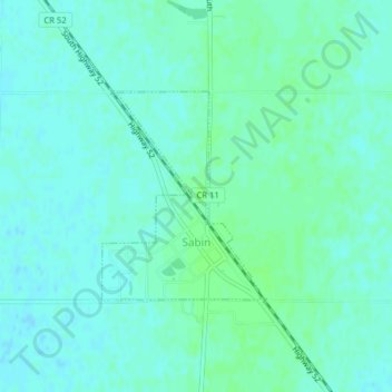
Mapa topográfico Sabin
Clique no mapa para exibir a altitude.
Obrigado por apoiar este site ❤️
Faça uma doação
Faça uma doação
Sabin
Sabin is mostly south under U.S. Route 52 and the shortline railway owned by Otter Tail Valley Railroad Company that runs parallel to Route 52. According to the United States Census Bureau, the city of Sabin has an area of 0.35 square miles (0.91 km2), all land. The elevation is approximately 929 feet.
Obrigado por apoiar este site ❤️
Faça uma doação
Faça uma doação
Sobre este mapa
Nome: Mapa topográfico Sabin, altitude, relevo.
Local: Sabin, Clay County, Minnesota, United States (46.77563 -96.66266 46.79006 -96.64677)
Altitude média: 282 m
Altitude mínima: 278 m
Altitude máxima: 285 m
Obrigado por apoiar este site ❤️
Faça uma doação
Faça uma doação
Outros mapas topográficos
Clique em um mapa para visualizar sua topografia, sua altitude e seu relevo.
Obrigado por apoiar este site ❤️
Faça uma doação
Faça uma doação
confluence of Red River of the North and Buffalo River
United States > Minnesota > Clay County
Altitude média: 268 m