Mapa topográfico Ashigarakami County
Clique no mapa para exibir a altitude.
Sobre este mapa
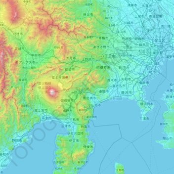
Nome: Mapa topográfico Ashigarakami County, altitude, relevo.
Local: Ashigarakami County, Kanagawa Prefecture, Japan (34.70321 138.37531 36.10321 139.77531)
Altitude média: 408 m
Altitude mínima: -3 m
Altitude máxima: 3.662 m
Outros mapas topográficos
Clique em um mapa para visualizar sua topografia, sua altitude e seu relevo.
Tokyo
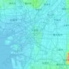
The mainland portion of Tokyo lies northwest of Tokyo Bay and measures about 90 km (56 mi) east to west and 25 km (16 mi) north to south. The average elevation in Tokyo is 40 m (131 ft). Chiba Prefecture borders it to the east, Yamanashi to the west, Kanagawa to the south, and Saitama to the north. Mainland…
Altitude média: 22 m

Sapporo
Sapporo is a city located in the southwest part of Ishikari Plain and the alluvial fan of the Toyohira River, a tributary stream of the Ishikari River. It is part of Ishikari Subprefecture. Roadways in the urban district are laid to make a grid plan. The western and southern parts of Sapporo are occupied by a…
Altitude média: 273 m

Okinawa Island
The Motobu Peninsula in the north has limestone layers and karst development. In the center and south is mainly a Ryukyu limestone layer and mudstone. The topography is flat, there are few hills over 100 m (328 ft) with very few rivers. The subtropical rains accelerate erosion so there are many drainages and…
Altitude média: 14 m
Sendai
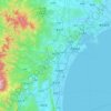
Sendai is located at lat. 38°16'05" north, long. 140°52'11" east. The city's area is 788.09 km2 (304.28 sq mi), and stretches from the Pacific Ocean to the Ōu Mountains, which are the east and west borders of Miyagi Prefecture. As a result, the city's geography is quite diverse. Eastern Sendai is a plains…
Altitude média: 185 m
Tokyo
The mainland portion of Tokyo lies northwest of Tokyo Bay and measures about 90 km (56 mi) east to west and 25 km (16 mi) north to south. The average elevation in Tokyo is 40 m (131 ft). Chiba Prefecture borders it to the east, Yamanashi to the west, Kanagawa to the south, and Saitama to the north. Mainland…
Altitude média: 22 m
Tokyo
The mainland portion of Tokyo lies northwest of Tokyo Bay and measures about 90 km (56 mi) east to west and 25 km (16 mi) north to south. The average elevation in Tokyo is 40 m (131 ft). Chiba Prefecture borders it to the east, Yamanashi to the west, Kanagawa to the south, and Saitama to the north. Mainland…
Altitude média: 22 m

Yokohama
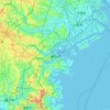
Yokohama has a total area of 437.38 km2 (168.87 sq mi) at an elevation of 5 metres (16 ft) above sea level. It is the capital of Kanagawa Prefecture, bordered to the east by Tokyo Bay and located in the middle of the Kantō plain. The city is surrounded by hills and the characteristic mountain system of the…
Altitude média: 23 m
Hokkaido
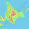
As Japan's coldest region, Hokkaidō has relatively cool summers and icy/snowy winters. Most of the island falls in the humid continental climate zone with Köppen climate classification Dfb (hemiboreal) in most areas but Dfa (hot summer humid continental) in some inland lowlands. The average August…
Altitude média: 98 m


Tokyo Bay
The shoal between Cape Futtsu in Chiba Prefecture and Cape Honmaku in Yokohama is known as Nakanose, and has a depth of 20 m (66 ft). North of this area the bay has a depth of 40 m (130 ft) and an uncomplicated underwater topography. Areas south of Nakanose are significantly deeper moving towards the Pacific…
Altitude média: 19 m

Nagano
Nagano (長野市, Nagano-shi, pronounced [nagaꜜno ɕi]) is the capital and largest city of Nagano Prefecture, located in the Nagano Basin (Zenkoji Daira) in the central Chūbu region of Japan. Nagano is categorized as a core city of Japan. Nagano City is the highest prefectural capital in Japan, with an…
Altitude média: 828 m


Hakone
Hakone is characterized by its rugged topography, featuring a mix of mountainous terrain, valleys, and volcanic landscapes. Nestled within the greater Fuji-Hakone-Izu National Park, Hakone's elevation varies dramatically, with peaks rising over 4,000 feet and low-lying areas near Lake Ashi, which sits at…
Altitude média: 722 m


Koga
Koga is located in the extreme southwestern corner of Ibaraki Prefecture. Located almost in the center of the Kanto Plain, the city is very flat. The Tone River flows eastward in the southern part of the city and the Watarase River flows through the west and joins the Tone River north of the Tonegawa…
Altitude média: 19 m


Yamato
Yamato is located in northeastern Kumamoto, bordering Miyazaki Prefecture. The northern part of the town is dominated by plateaus on the southern outer rim of Mount Aso, and borders Minamiaso village and Takamori town via a mountain pass at an elevation of about 1000 meters. The southern part of the town is in…
Altitude média: 651 m


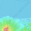


Akiota
Akiōta is in the Chūgoku Mountains of north-western Hiroshima, bordered by Shimane Prefecture to the north. Due to its location and elevation, it is a heavy snowfall region.
Altitude média: 676 m

Miyoshi
Miyoshi is located almost in the middle of the Chugoku region, with the Chugoku Mountains to the north and a flat agricultural area to the south. Together with the neighboring city of Shōbara, it forms the northern part of the prefecture called the "Bihoku region". Because the tributaries of the Enokawa River…
Altitude média: 386 m

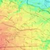
Nerima
The entire ward lies within the Musashino Plateau and features soil composed of loam formed from volcanic ash. The highest point in the 23 wards is in Nerima Ward, around Musashi-Seki Park. There are two peaks in the plateau at an altitude of about 58m in Sekimachi-Minami 4th Street and Sekimachi-Kita 4th…
Altitude média: 43 m
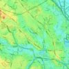


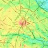
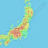

Akishima
Akishima is located on the left bank of the Tama River, about 35 kilometers west of central Tokyo. The Tamagawa Aqueduct flows in the northern part of the city. The city area generally slopes gently from northwest to southeast toward the Tama River, which flows to the south of the city. The altitude of the…
Altitude média: 112 m

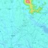
Tsukuba
Tsukuba is located in southern Ibaraki Prefecture, approximately 50 kilometers from central Tokyo and about 40 kilometers from Narita International Airport. Mount Tsukuba, from which the city takes its name, is located in the northern part of the city. Except for the area around Mount Tsukuba, the city is a…
Altitude média: 35 m


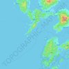
Nagasaki
On the day of the nuclear strike (August 9, 1945) the population in Nagasaki was estimated to be 263,000, which consisted of 240,000 Japanese residents, 10,000 Korean residents, 2,500 conscripted Korean workers, 9,000 Japanese soldiers, 600 conscripted Chinese workers, and 400 Allied POWs. That day, the Boeing…
Altitude média: 44 m


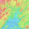

Isumi
Isumi is located on the east coast of southern Chiba Prefecture, on the Bōsō Peninsula. It is bordered by the Pacific Ocean to the east, and enjoys a temperate maritime climate, with short, cool winters and hot, humid summers due to the effects of the Kuroshio Current offshore. The area is noted for its…
Altitude média: 30 m

Tsumagoi
Tsumagoi has a humid continental climate (Köppen Dfb) characterized by warm summers and cold winters with heavy snowfall, due to the high elevation. Winters are cold, with a January 24-hour average temperature of −4.6 °C (23.7 °F), while summers are warm and wet, with a July 24-hour average temperature of…
Altitude média: 1.309 m



Okinawa Island
The Motobu Peninsula in the north has limestone layers and karst development. In the center and south is mainly a Ryukyu limestone layer and mudstone. The topography is flat, there are few hills over 100 m (328 ft) with very few rivers. The subtropical rains accelerate erosion so there are many drainages and…
Altitude média: 14 m


Kanagawa Prefecture
Topographically, the prefecture consists of three distinct areas. The mountainous western region features the Tanzawa Mountain Range and the volcano Mount Hakone. The hilly eastern region is characterized by the Tama Hills and Miura Peninsula. The central region, which surrounds the Tama Hills and Miura…
Altitude média: 170 m


Nikkō
Nikkō is a popular destination for Japanese and international tourists. Attractions include the mausoleum of shōgun Tokugawa Ieyasu at the Nikkō Tōshō-gū shrine, and that of his grandson Tokugawa Iemitsu (Iemitsu-byō Taiyū-in), along with Futarasan shrine, which dates to the year 767. There are many…
Altitude média: 802 m
Kamakura
The Kamakura shogunate era is called by historians the Kamakura period and, although its end is clearly set (Siege of Kamakura (1333)), its beginning is not. Different historians put Kamakura's beginning at a different point in time within a range that goes from the establishment of Yoritomo's first military…
Altitude média: 33 m

Shinjuku
Naturally, most of Shinjuku is occupied by the Yodobashi Plateau, the most elevated portion of which extends through most of the Shinjuku Station area. The Kanda River runs through the Ochiai and Totsuka areas near sea level, but the Toshima Plateau also builds elevation in the northern extremities of Totsuka…
Altitude média: 35 m

Kyushu Region
The total area is 36,782.37 km2 (14,201.75 sq mi) which makes it the 37th largest island in the world. It is slightly larger than Taiwan's total area of 35,808 km2 (13,826 sq mi). The highest elevation is 1791 meters (5876 feet) on Mount Kujū.
Altitude média: 23 m
Shinjuku
Most of Shinjuku is occupied by the Yodobashi Plateau, the most elevated portion of which extends through most of the Shinjuku Station area. The Kanda River runs through the Ochiai and Totsuka areas near sea level, but the Toshima Plateau also builds elevation in the northern extremities of Totsuka and Ochiai.…
Altitude média: 35 m
Takayama
Takayama (高山市, Takayama-shi) is a city located in Gifu Prefecture, Japan. As of 1 January 2019, the city had an estimated population of 88,473 in 35,644 households, and a population density of 41 persons per km2. The total area of the city was 2,177.61 square kilometres (840.78 sq mi) making it the…
Altitude média: 1.157 m
Gotemba
Gotemba is located in far eastern Shizuoka Prefecture at an altitude of 250–600 metres (820–1,970 ft). Mount Fuji is located to the west, and Mount Hakone to the east, with the Tanzawa Mountains to the north and Mount Ashitaka to the south. The area is noted for its numerous golf courses, with the Mitsui…
Altitude média: 650 m