
Mapa topográfico Portadown
Mapa interativo
Clique no mapa para exibir a altitude.
Sobre este mapa
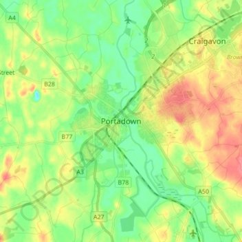
Nome: Mapa topográfico Portadown, altitude, relevo.
Altitude média: 28 m
Altitude mínima: 1 m
Altitude máxima: 67 m
Outros mapas topográficos
Clique em um mapa para visualizar sua topografia, sua altitude e seu relevo.
Loughgall
United Kingdom > Northern Ireland > County Armagh
Loughgall, County Armagh, Ulster, Northern Ireland, BT61 8HY, United Kingdom
Altitude média: 32 m
Armagh
United Kingdom > Northern Ireland > County Armagh > Armagh
Armagh, County Armagh, Ulster, Northern Ireland, United Kingdom
Altitude média: 100 m
Lurgan
United Kingdom > Northern Ireland > County Armagh > Lurgan
Lurgan, County Armagh, Northern Ireland, United Kingdom
Altitude média: 48 m