Mapa topográfico Akole
Clique no mapa para exibir a altitude.
Akole
Kalsubai is the highest peak in Maharashtra, with an elevation of 1,646 meters (5,400 feet). Ghatghar, located 22 kilometers (14 miles) from Bhandardara, offers views of the Sahyadri range and is the site of the Udanchan Hydro-power project's first installation, which has a capacity of 250 MW. Additionally, Kokan Kada, situated near Harishchandragad, is known for its flat, sharp, and deeply edged mountainous terrain.
Sobre este mapa
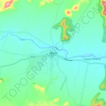
Nome: Mapa topográfico Akole, altitude, relevo.
Local: Akole, Akola, Ahmednagar District, Maharashtra, 422600, India (19.38193 73.84926 19.70193 74.16926)
Altitude média: 749 m
Altitude mínima: 553 m
Altitude máxima: 1.471 m
Outros mapas topográficos
Clique em um mapa para visualizar sua topografia, sua altitude e seu relevo.