
Faça uma doação
Mapa topográfico Findlay
Clique no mapa para exibir a altitude.
Faça uma doação
Findlay
Findlay is situated on relatively flat terrain within the northwest region of the state, characterized by gently rolling hills and fertile plains. The city lies at an elevation of approximately 800 feet (244 meters) above sea level, with the Blanchard River meandering through the area, contributing to the landscape's gentle undulations. The surrounding region features rich agricultural land, making it well-suited for farming, while nearby woodlands and small parks provide pockets of natural beauty. This topography, combined with the river's proximity, creates a picturesque environment that supports both urban development and outdoor recreational opportunities.
Faça uma doação
Sobre este mapa
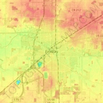
Nome: Mapa topográfico Findlay, altitude, relevo.
Local: Findlay, Hancock County, Ohio, United States (40.99265 -83.68940 41.08993 -83.57347)
Altitude média: 243 m
Altitude mínima: 211 m
Altitude máxima: 261 m
Faça uma doação
Outros mapas topográficos
Clique em um mapa para visualizar sua topografia, sua altitude e seu relevo.