
Obrigado por apoiar este site ❤️
Faça uma doação
Faça uma doação
Mapa topográfico Big Bear Lake
Clique no mapa para exibir a altitude.
Obrigado por apoiar este site ❤️
Faça uma doação
Faça uma doação
Big Bear Lake
At a surface elevation of 6,743 ft (2,055 m) above sea level, it has an east-west length of approximately seven miles (11 km) and is approximately 2.5 miles (4.0 km) at its widest measurement, though the lake's width mostly averages a little more than 1⁄2 mi (0.8 km). These approximations are based on the lake having an optimum retainable water level. At dam's end, Big Bear measures its deepest water at 72 feet (22 m).
Obrigado por apoiar este site ❤️
Faça uma doação
Faça uma doação
Sobre este mapa
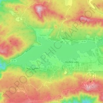
Nome: Mapa topográfico Big Bear Lake, altitude, relevo.
Altitude média: 2.209 m
Altitude mínima: 1.905 m
Altitude máxima: 2.544 m
Obrigado por apoiar este site ❤️
Faça uma doação
Faça uma doação