
Mapa topográfico Hauslweid
Mapa interativo
Clique no mapa para exibir a altitude.
Sobre este mapa
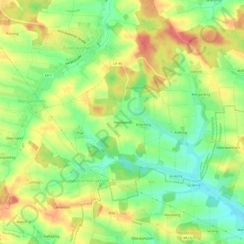
Nome: Mapa topográfico Hauslweid, altitude, relevo.
Altitude média: 485 m
Altitude mínima: 453 m
Altitude máxima: 518 m
Outros mapas topográficos
Clique em um mapa para visualizar sua topografia, sua altitude e seu relevo.
Emiching
Deutschland > Bayern > Landkreis Landshut > Haunzenbergersöll > Emiching
Emiching, Haunzenbergersöll, Bodenkirchen, Landkreis Landshut, Bayern, 84573, Deutschland
Altitude média: 484 m