
Mapa topográfico Knottenried
Mapa interativo
Clique no mapa para exibir a altitude.
Sobre este mapa
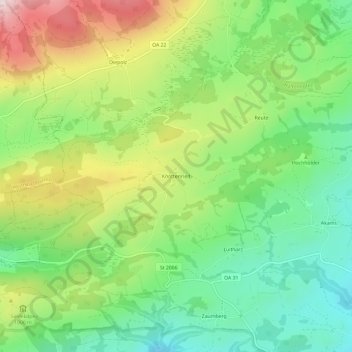
Nome: Mapa topográfico Knottenried, altitude, relevo.
Altitude média: 948 m
Altitude mínima: 766 m
Altitude máxima: 1.235 m
Outros mapas topográficos
Clique em um mapa para visualizar sua topografia, sua altitude e seu relevo.
Gschwender Horn
Deutschland > Bayern > Landkreis Oberallgäu > Immenstadt im Allgäu
Gschwender Horn, Immenstadt im Allgäu, Landkreis Oberallgäu, Bayern, Deutschland
Altitude média: 1.200 m