
Mapa topográfico Inverlochlarig
Clique no mapa para exibir a altitude.
Sobre este mapa
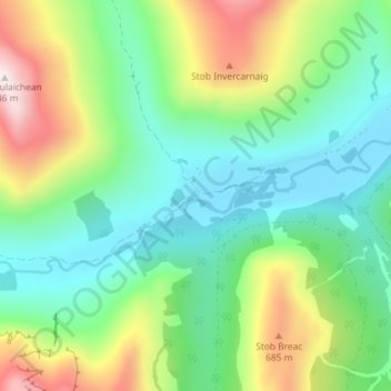
Nome: Mapa topográfico Inverlochlarig, altitude, relevo.
Local: Inverlochlarig, Stirling, Scotland, FK19 8PH, United Kingdom (56.31012 -4.54801 56.35012 -4.50801)
Altitude média: 379 m
Altitude mínima: 125 m
Altitude máxima: 937 m