
Mapa topográfico Almoster
Mapa interativo
Clique no mapa para exibir a altitude.
Sobre este mapa
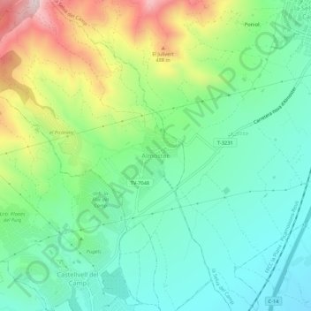
Nome: Mapa topográfico Almoster, altitude, relevo.
Local: Almoster, Baix Camp, Tarragona, Catalonia, 43393, Spain (41.17606 1.09114 41.21606 1.13114)
Altitude média: 289 m
Altitude mínima: 139 m
Altitude máxima: 613 m
Its climate is dry Mediterranean, with low rainfall in the summer and occasionally heavy rainfall in spring and autumn. The driest month is July, with an average rainfall of only 15 mm, and September is usually the wettest, with an average of about 75 mm. The average annual precipitation barely reaches 500 mm. The most mountainous part of the township has a continental Mediterranean climate and more rain as there is a small thermal contrast with the more southerly and lower elevation. The average temperature of the warmest month, August, is about 24 º and the coldest month, January, is about -2 to 00.