
Mapa topográfico Shaniko
Mapa interativo
Clique no mapa para exibir a altitude.
Shaniko
The city is at an elevation of 3,343 feet (1,019 m). On the high plateau on which Shaniko was built, the soil is thin and the vegetation sparse, consisting mainly of sagebrush, bunchgrass, and occasional junipers. Many peaks of the Cascade Range, including Hood, Jefferson, Adams, St. Helens and Rainier, are visible from the city.
Sobre este mapa
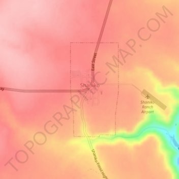
Nome: Mapa topográfico Shaniko, altitude, relevo.
Local: Shaniko, Wasco County, Oregon, United States (44.99660 -120.75733 45.01082 -120.74709)
Altitude média: 1.009 m
Altitude mínima: 900 m
Altitude máxima: 1.038 m