
Faça uma doação
Mapa topográfico Dir
Clique no mapa para exibir a altitude.
Faça uma doação
Dir
The topography of Upper Dir is dominated by high mountains. The most important mountain range is the Hindu Kush. It runs from north east to south west along the northern borders with Chitral District. In winter whole area remains snow-covered. The mountains in the western part of the district are covered with forests, while the eastern mountain range, Dir Kohistan is barren. Panjkora River is the main river of the district, which originates from Dir Kohistan. Upper Dir headquarters is connected to all tehsil headquarters.
Faça uma doação
Sobre este mapa
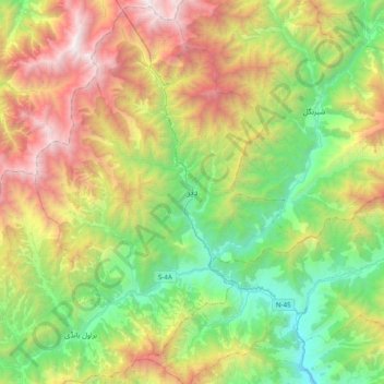
Nome: Mapa topográfico Dir, altitude, relevo.
Altitude média: 2.204 m
Altitude mínima: 1.018 m
Altitude máxima: 4.266 m
Faça uma doação
Outros mapas topográficos
Clique em um mapa para visualizar sua topografia, sua altitude e seu relevo.