
Mapa topográfico Richland
Mapa interativo
Clique no mapa para exibir a altitude.
Richland
According to the United States Census Bureau, the city has a total area of 39.11 square miles (101.29 km2), of which, 35.72 square miles (92.51 km2) is land and 3.39 square miles (8.78 km2) is water. Elevation at the airport is 120 m (390 ft).
Sobre este mapa
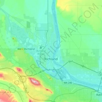
Nome: Mapa topográfico Richland, altitude, relevo.
Local: Richland, Benton County, Washington, United States (46.19440 -119.40044 46.37063 -119.21148)
Altitude média: 160 m
Altitude mínima: 93 m
Altitude máxima: 483 m