
Mapa topográfico Sicilì
Clique no mapa para exibir a altitude.
Sobre este mapa
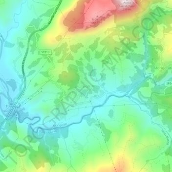
Nome: Mapa topográfico Sicilì, altitude, relevo.
Local: Sicilì, Morigerati, Salerno, Campania, Italy (40.11566 15.51179 40.15566 15.55179)
Altitude média: 228 m
Altitude mínima: 34 m
Altitude máxima: 688 m
Outros mapas topográficos
Clique em um mapa para visualizar sua topografia, sua altitude e seu relevo.
Acerno
The communal territory has an elevation varying between 400 and 1790 metres above sea level. Outside of the town itself it is entirely uninhabited by humans: there are no satellite hamlets or even scattered dwellings under permanent habitation. It is rich in flora, however, with forests of maple, oak,…
Altitude média: 954 m