

Mapa topográfico Guwahati
Clique no mapa para exibir a altitude.
Guwahati
Professor Abani Kumar Bhagawati of Gauhati University stated that since before there were sufficient wetlands to absorb rainwater and channels to carry excess water to the Brahmaputra, the city did not experience floods. However, human interference has disrupted the natural topography, leading to the current situation where "just half an hour of rain" can cause flooding in the city. Encroachment and concretization, which reduce open areas for natural water absorption, are the primary causes of floods according to Bhagawati.
Sobre este mapa
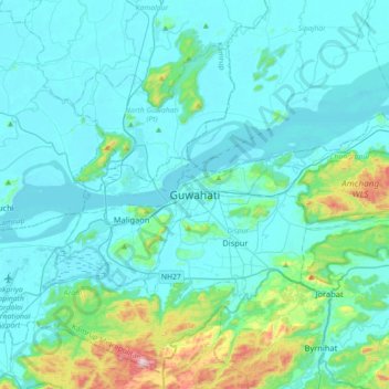
Nome: Mapa topográfico Guwahati, altitude, relevo.
Local: Guwahati, Kamrup Metropolitan, Assam, 781015, India (26.02060 91.59394 26.34060 91.91394)
Altitude média: 113 m
Altitude mínima: 40 m
Altitude máxima: 621 m
Outros mapas topográficos
Clique em um mapa para visualizar sua topografia, sua altitude e seu relevo.
