
Mapa topográfico Arciprestazgo de Alcalá Sur
Mapa interativo
Clique no mapa para exibir a altitude.
Sobre este mapa
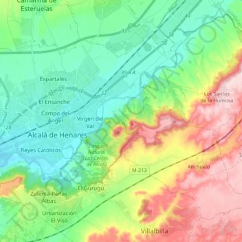
Nome: Mapa topográfico Arciprestazgo de Alcalá Sur, altitude, relevo.
Altitude média: 685 m
Altitude mínima: 576 m
Altitude máxima: 899 m
Standing at an average altitude of 654 m, and occupying some 88 km2; the city was for a long time contained in between the Henares to the South and the Madrid-Barcelona railway to the North. However, the increasing population brought on the sprawl of the urbanised area to the area located in between the railway and the A-2 motorway and beyond.