
Mapa topográfico Zell am Pettenfirst
Mapa interativo
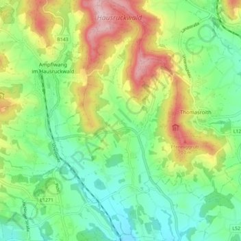
Clique no mapa para exibir a altitude.
Sobre este mapa
Nome: Mapa topográfico Zell am Pettenfirst, altitude, relevo.
Altitude média: 577 m
Altitude mínima: 482 m
Altitude máxima: 743 m
Die Ortschaft Zell am Pettenfirst liegt auf etwa 550 Meter Höhe. Der Pettenfirst, der Hausberg der Zeller, erreicht eine Höhe von über 700 Metern.