
Faça uma doação
Mapa topográfico Howe Island
Clique no mapa para exibir a altitude.
Faça uma doação
Sobre este mapa
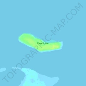
Nome: Mapa topográfico Howe Island, altitude, relevo.
Local: Howe Island, North Slope, Alaska, United States (70.31232 -148.00347 70.31825 -147.96204)
Altitude média: 0 m
Altitude mínima: -1 m
Altitude máxima: 11 m
Faça uma doação
Outros mapas topográficos
Clique em um mapa para visualizar sua topografia, sua altitude e seu relevo.
Atqasuk
United States > Alaska > North Slope
Atqasuk has one airport, Atqasuk Edward Burnell Sr. Memorial Airport, that is uncontrolled and has a single 4,370-by-90-foot (1,332 by 27 m) runway at an elevation of 96 feet (29 m).
Altitude média: 20 m
Faça uma doação
Deadhorse
United States > Alaska > North Slope
In February 2023, a "high altitude object" about the size of a small car was shot down near the area after a decision by President Joe Biden.
Altitude média: 15 m
Faça uma doação