
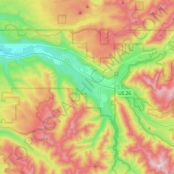
Mapa topográfico The Villages at Mount Hood
Mapa interativo
Clique no mapa para exibir a altitude.
Sobre este mapa
Nome: Mapa topográfico The Villages at Mount Hood, altitude, relevo.
Local: The Villages at Mount Hood, Clackamas County, Oregon, USA (45.30294 -122.13441 45.40378 -121.88241)
Altitude média: 797 m
Altitude mínima: 256 m
Altitude máxima: 1.504 m