
Mapa topográfico Hunau
Mapa interativo
Clique no mapa para exibir a altitude.
Sobre este mapa
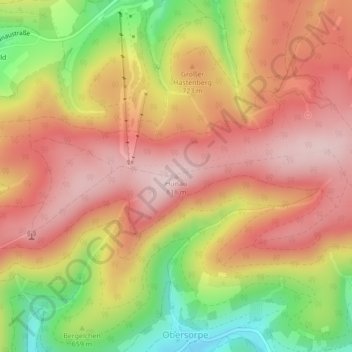
Nome: Mapa topográfico Hunau, altitude, relevo.
Altitude média: 699 m
Altitude mínima: 520 m
Altitude máxima: 817 m
Outros mapas topográficos
Clique em um mapa para visualizar sua topografia, sua altitude e seu relevo.
Gellinghausen
Duitsland > Noordrijn-Westfalen > Schmallenberg > Gellinghausen
Gellinghausen, Schmallenberg, Hochsauerlandkreis, Noordrijn-Westfalen, Duitsland
Altitude média: 565 m
Lengenbeck
Duitsland > Noordrijn-Westfalen > Schmallenberg > Lengenbeck
Lengenbeck, Schmallenberg, Hochsauerlandkreis, Noordrijn-Westfalen, Duitsland
Altitude média: 590 m